Loading the point cloud
Balayage 0 %
Method

From the apron to the dimensioned plan

An aircraft survey happens on the ground, between two rotations, with limited access time. The method is built to capture everything in one go and never have to come back.

  1. PrepareWalk-through with the engineering team: useful zones (main deck, lower hold, doors), apron safety, scanning order. Two configurations planned: doors open, then doors closed with the stairs.
  2. ScanA 3D laser scanner on a tripod, moved station by station through the whole aircraft. Each station measures millions of points and shoots an HDR 360° photo from exactly the same spot.
  3. RegisterStations are assembled in registration software: each scan is positioned against its neighbours using shared surfaces, then the error is checked station by station.
  4. CleanNoise and stray objects are removed, then the data is exported as E57, an open format every CAD package can read.
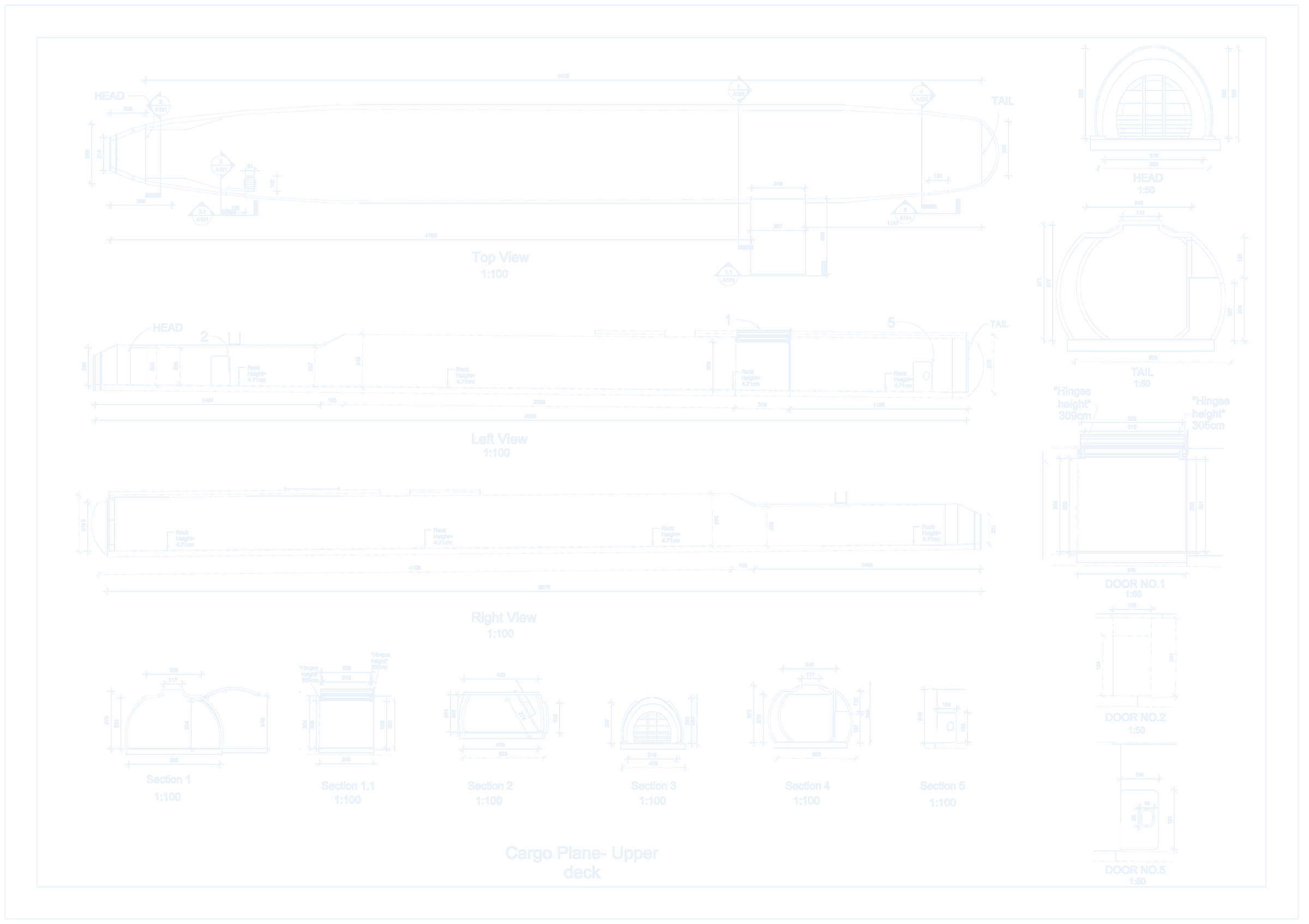
  5. Draw and dimensionCuts and sections are extracted from the cloud and redrawn in CAD: top view, profiles, sections, every door in detail. Dimensions in centimetres, delivered as DWG and PDF.
  6. CheckPlan dimensions are cross-checked against the cloud, then future loading equipment is tested against the door envelopes.
  7. ShareLight point cloud, panoramas and model brought together in a web experience the whole team opens in a browser, with no specialist software.
50stations
2decks
2door configurations
16K360° panoramas

Tools tripod-mounted 3D laser scanner · field tablet · registration software · CAD · web 3D engine

Deliverables E57 · DWG · PDF · JPG and EXR panoramas · web experience

View mode
Plan coté du pont principal : vue de dessus, profils, sections et portes
Plan relevé · pont principal · 1:100
Case study · Challenge Airlines

A 747 freighter, laser-scanned

To design new loading equipment, Challenge Airlines' engineering team needed to know the inside of their aircraft to the centimetre. We scanned both decks, shot every station in 360° and delivered dimensioned plans.

Scroll to follow the project ↓
STA 01 · The need

Everything goes through the door

Before drawing a crate, a rack or a container, you need the exact limits of every opening and the volume really available on board. A few centimetres off, and the cargo stays on the apron.

STA 02 · Capture

Station by station

A 3D laser scanner on a tripod, moved through the aircraft. At every stop, millions of measured points and a 360° photo taken from exactly the same position. Each bubble is the real panorama of its station.

Station 0 / 8
50~500 M2stationspoints measureddecks
On site · 1 min

A day on the apron

The scanner goes on board, station after station, while the team follows the registration on a tablet. Then the cloud goes back to the office, where it becomes dimensioned plans.

Capture, registration and drafting, silent edit.
STA 03 · Assemble

One measurable model

Stations are registered together into a single cloud. The whole main deck, from the nose to the aft bulkhead, becomes a model you can measure without going back to the apron.

STA 04 · Measure

The main cargo door

It sets the maximum size of everything that goes onto the main deck. Measured in the cloud, cross-checked against the plan.

349 cmwidth
305 cmheight under hinges
STA 05 · See

360° tour on board

Every scanner position is linked to its 360° photo. You move from station to station, from the cargo door to the nose, switching from the cloud to the real view without changing viewpoint.

Station 1 / 6
STA 06 · Lower deck

The lower hold, lower ceiling

Same method below the floor. The ceiling is low here and every centimetre of height counts for containers.

272 cmdoor width
167 cmheight under hinges
STA 07 · Model

The model laid on the scan

A 747-400 freighter model is fitted to the cloud, door against door. Then the cloud turns into a model: the cabin is rebuilt as a surface from the points, frame by frame.

The switch at the top of the screen does the same, everywhere: Point cloud, Overlay, Model.

STA 08 · Plans

From cloud to dimensioned plan

The cloud is redrawn as DWG and PDF plans: top view, left and right profiles, sections and every door in detail, dimensioned in centimetres. It is the engineers' working document.

Delivery

A measurable twin of the aircraft

  • E57Registered point clouds, main deck and lower hold
  • 360°High-definition panoramas at every station
  • DWGDimensioned plans: views, sections, doors
  • CargoEnvelope checks before manufacturing
Magmavox

An aircraft, a hangar, a site to survey?

We scan, photograph and model your technical spaces, then turn them into usable plans and web experiences your teams and clients understand at a glance.

  • 3DLaser survey, registered point cloud, model
  • 360°High-definition virtual tours
  • CADDimensioned DWG and PDF plans
  • WebCustom interactive experiences
Let's talk about your projectinfo@magmavox.com
Drag to turn · wheel or pinch to zoom · click a yellow dot to enter the 360°

Does it fit?

Enter the dimensions of a crate. It is tested in every orientation against both surveyed doors.
Example loaded: 318 × 244 cm pallet base, 160 cm high. Envelopes from the surveyed plans (main door 349 × 305 cm, lower hold 261 × 163 cm clear). Rotation inside the aircraft and handling margins not included.
Panorama